🕐 Preservation Through Deep Time
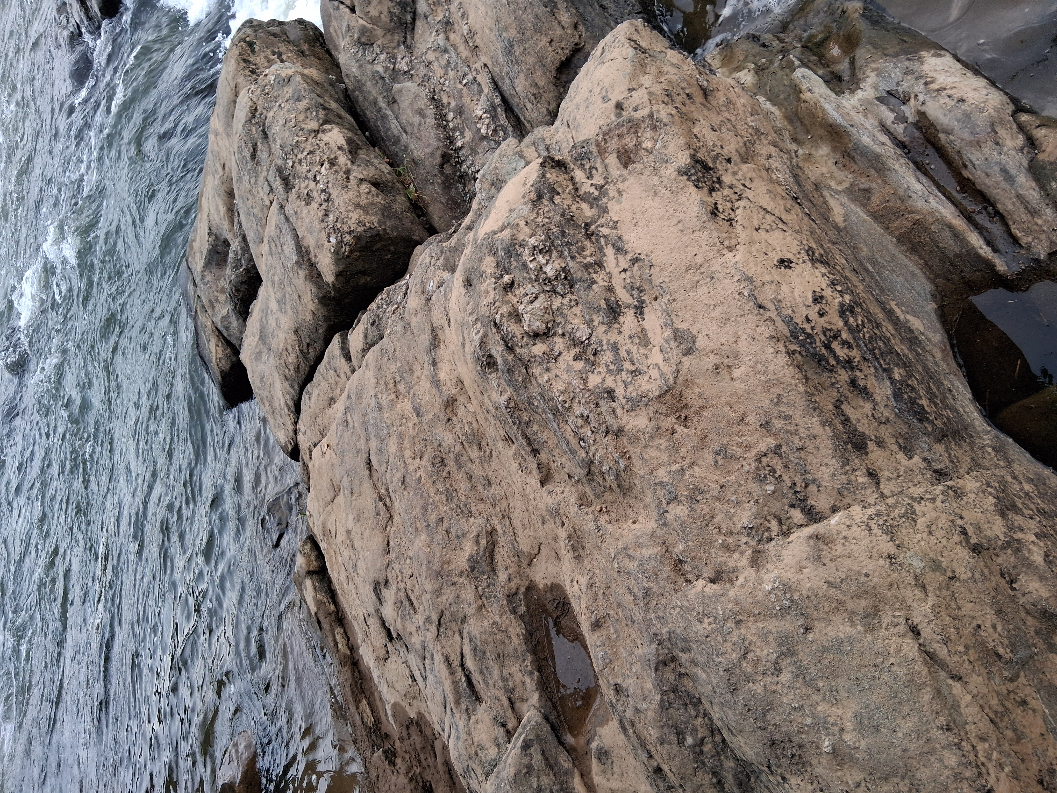
The fall line represents the collision between ancient Piedmont crystalline rocks over 500 million years old and the younger Coastal Plain sediments. The Fredericksburg Complex consists primarily of biotite granite, gneiss, and schist with distinctive orthogonal fracture patterns creating naturally angular, "squarish" stones.
Iron Rich Resources
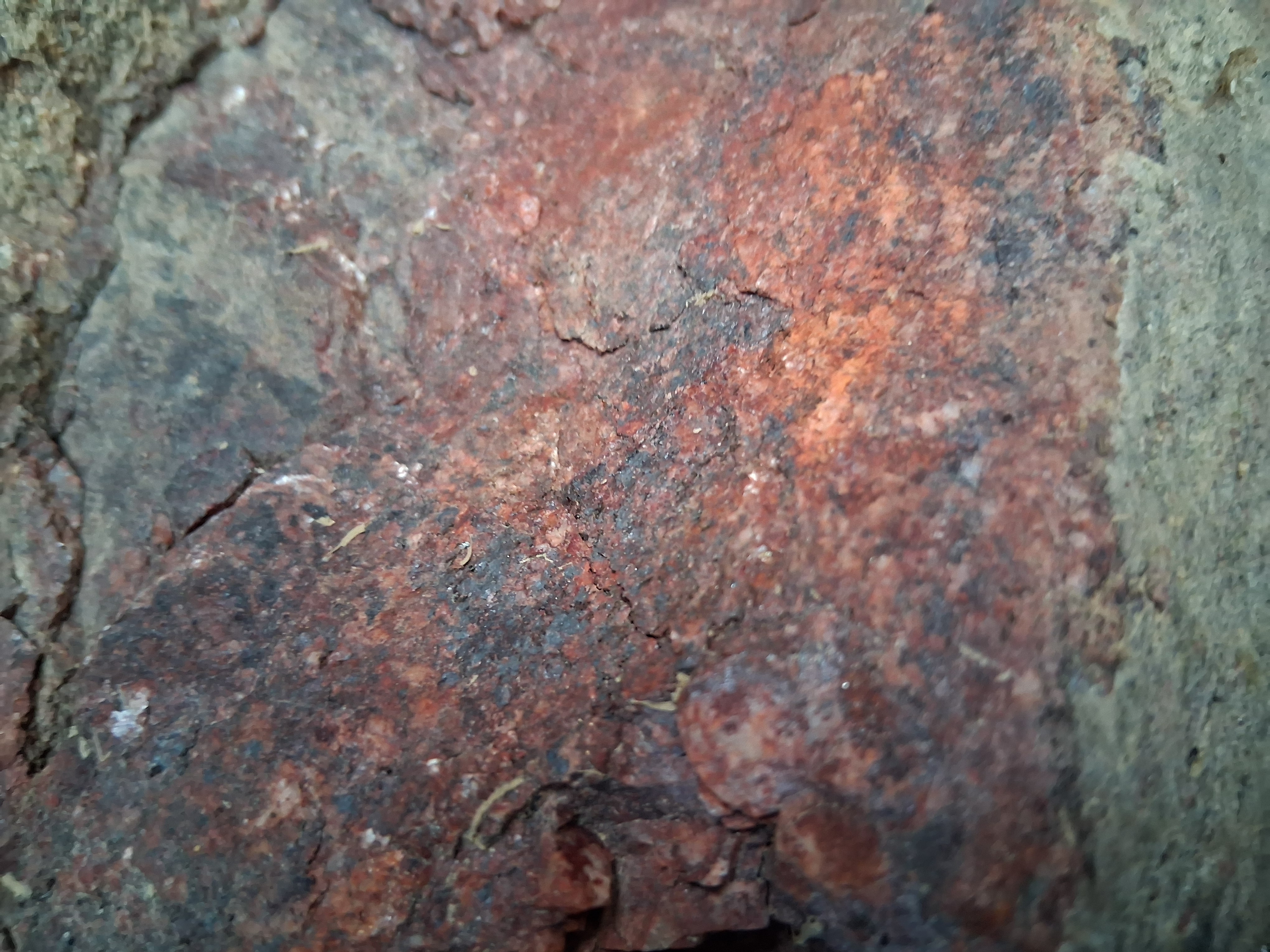
The rock in this photo is part of a larger formation known as the **Fredericksburg Complex**, a type of ancient, hard metamorphic rock found throughout the Rappahannock River’s fall line. Its reddish color comes from iron minerals like **hematite**, which have oxidized over time — a natural process similar to rust forming on metal. This type of rock, which likely began as granite deep underground, was transformed over **hundreds of millions of years** through intense heat and pressure during massive tectonic events that shaped the Appalachian Mountains. For the Native American tribes who lived here — including the Rappahannock, Patawomeck, and Manahoac — this kind of stone had many uses. It was durable and could be shaped into tools or used to carve important symbols and petroglyphs. The red coloring may have also held spiritual significance, since red ochre (a pigment made from iron-rich earth) was often used in ceremonies and burials. Because these rocks are found right where the river shifts from rocky rapids to calmer, tidal waters, this area naturally became a key spot for travel, fishing, ceremony, and settlement. The geology of the Rappahannock River didn’t just shape the land — it shaped the culture, spirituality, and survival of the people who lived here.
Mysteries Still Left Untouched
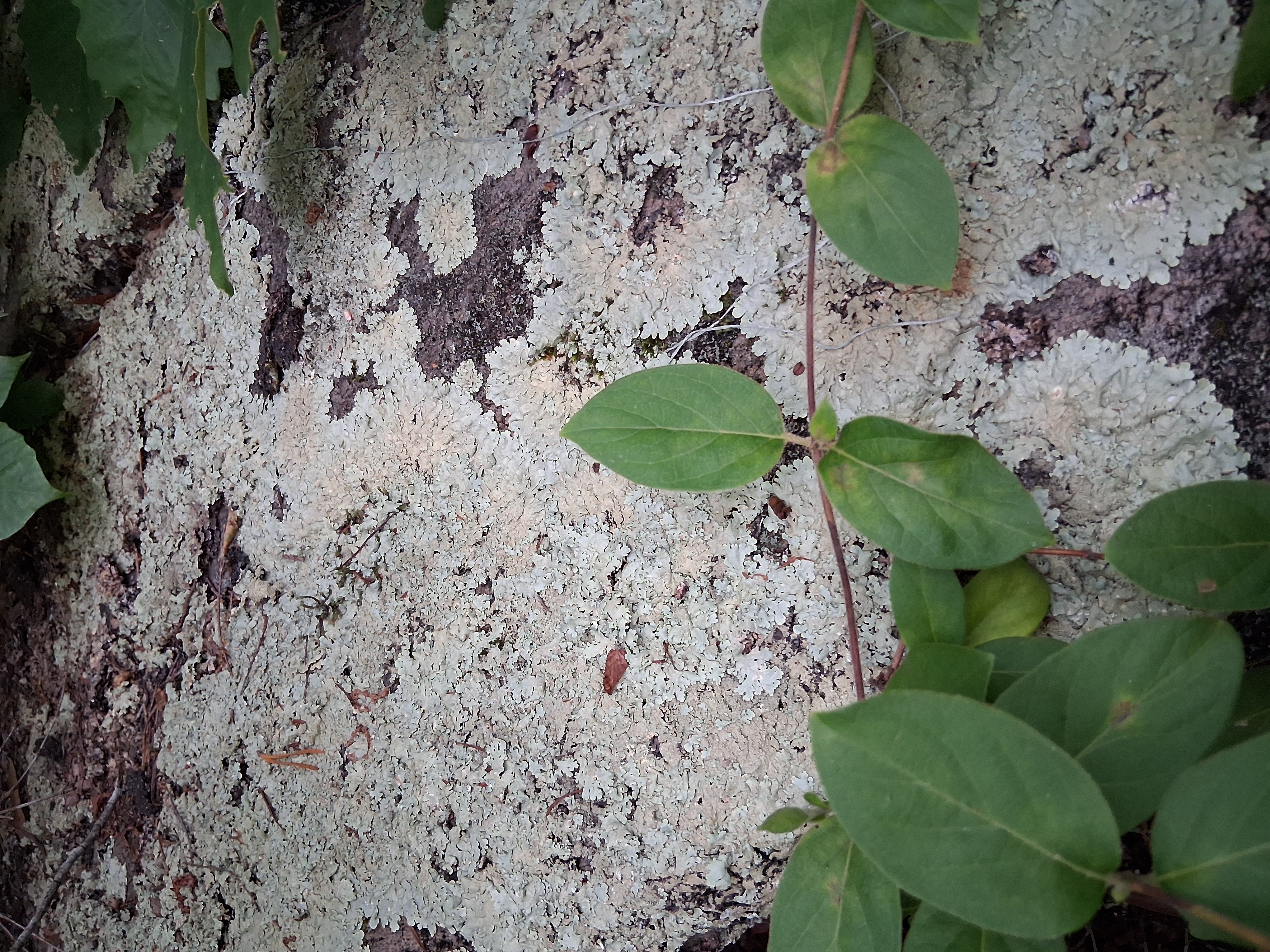
The presence of lichen on the rocks indicates that these surfaces have been exposed and stable for a long time (lichens grow slowly on rock, often taking decades to form noticeable patches). This suggests that the carved features have not been recently moved or significantly eroded – they sit where ancient people left them, at least within the scale of centuries.
Fall Line Formation
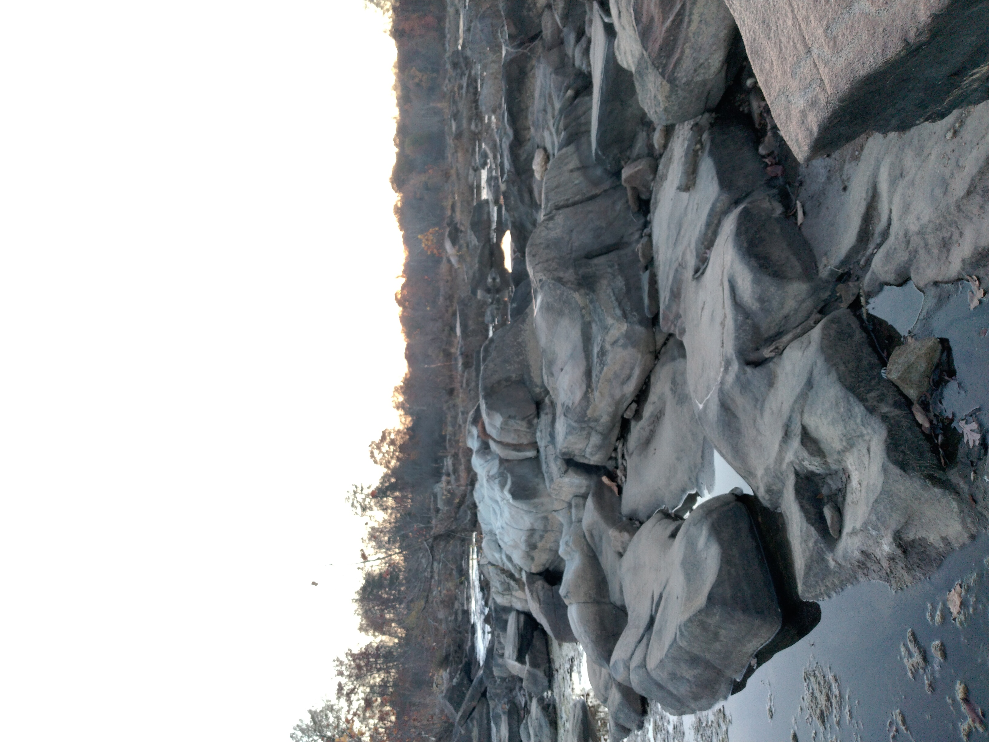
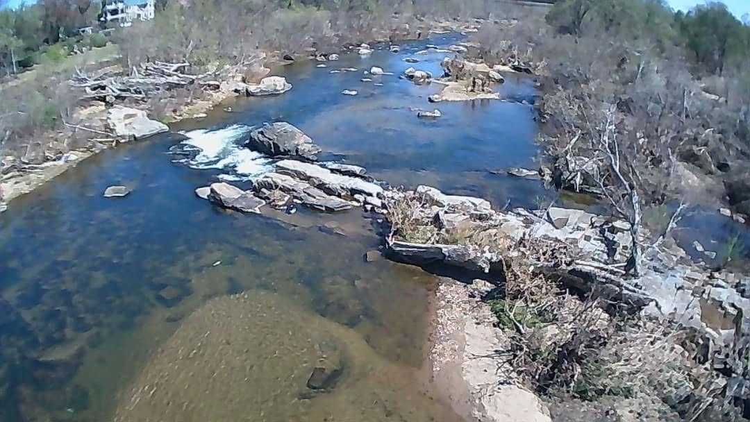
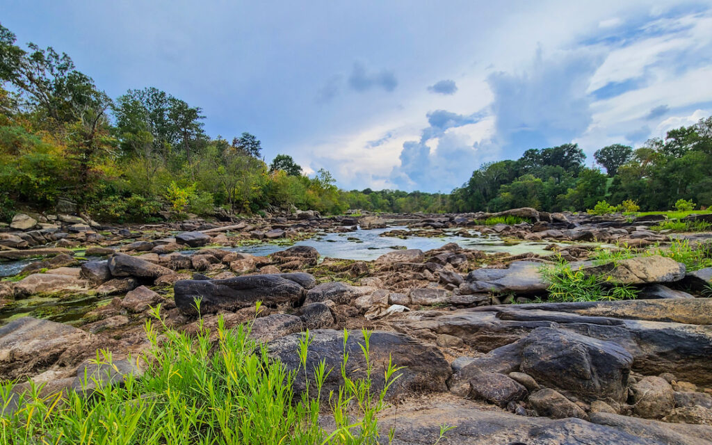
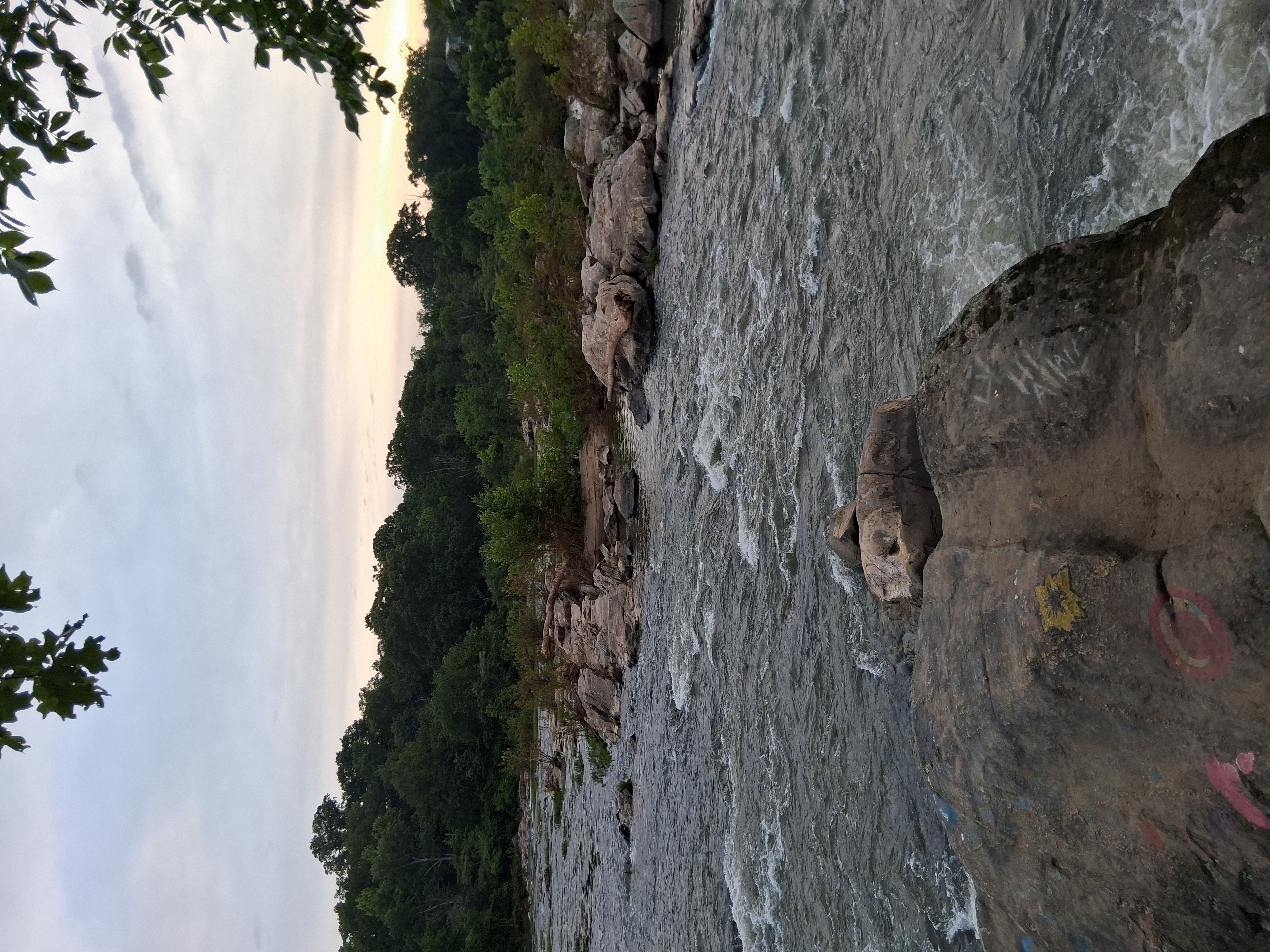
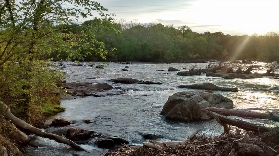
The **Fall Line** is a natural boundary where the rocky highlands of the Piedmont region meet the flat coastal plain. At the Rappahannock River, this creates a dramatic shift from fast-moving rapids and exposed bedrock — like those pictured here — to the slower, meandering waters that eventually reach the Chesapeake Bay. For Native peoples, this area was more than just a geographic feature — it was a critical **hub of life, movement, and meaning**. The rapids oxygenated the water and created perfect conditions for fish like shad and herring to spawn, making it a prime site for **fishing, hunting, and gathering**. The rocky outcrops and islands made ideal spots for building **fish weirs**, resting, navigating, and performing sacred rites. This stretch of river was a **liminal zone** — a threshold between worlds — that held deep **spiritual importance**. It was where natural resources were abundant, where trade paths converged, and where the land and water themselves seemed to speak with power. The Fall Line made this section of the Rappahannock one of the most culturally and ecologically significant places in the region.
The "Squarish Stones" Formation
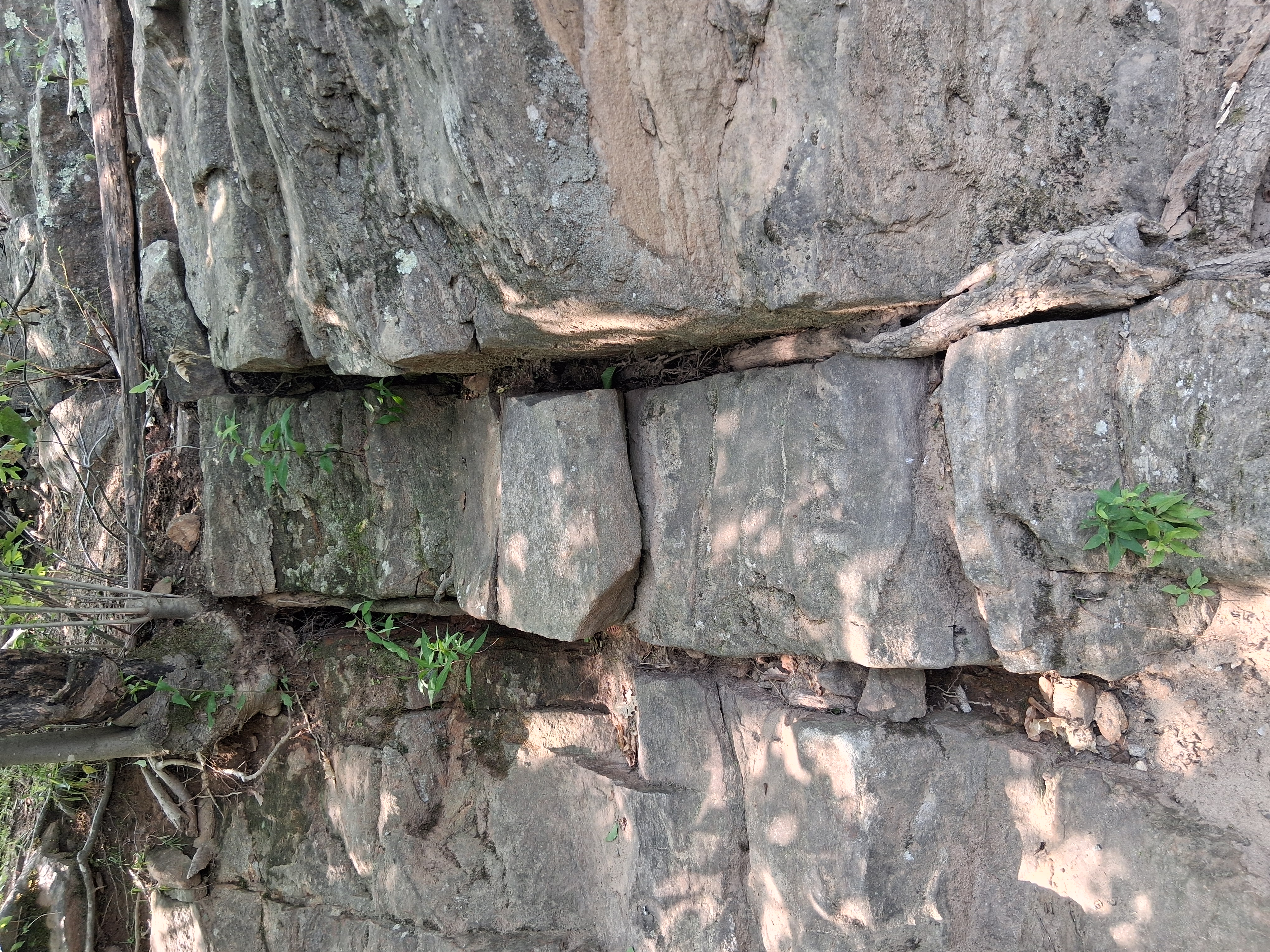
These massive, angular stones with clear 90-degree fracture patterns suggest granite or granitic gneiss with strong jointing. The red and pink tones visible hint at high feldspar and quartz content, possibly potassium feldspar giving that distinctive reddish hue. The stones are massive, angular, and jointed, with clear orthogonal fracture patterns suggesting granite or granitic gneiss with strong jointing. 🪨 Formation Process Likely formed from ancient tectonic activity and uplift, exposing Precambrian to Cambrian bedrock common in this part of the Piedmont region. Over time, weathering along cracks naturally formed these cubic boulders. The blocky shapes are not man-made, but they are eerily geometric, which may have influenced Indigenous people to see them as sacred or useful.
Perfect for Sacred Use
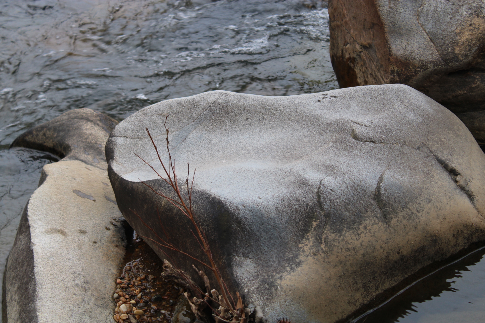
Along the Rappahannock River’s Fall Line, stones like the one in the photo above weren’t just geological features—they were natural altars. Smoothed and sculpted by millennia of flowing water, these rocks created perfect surfaces for Native people to sit, gather, observe the river, or engage in ceremonial activities. Their weather-worn shapes resemble seats, cradles, and platforms—often facing east or overlooking key spots along the waterway. These formations provided quiet, elevated spaces removed from the bustle of village life, ideal for prayer, vision-seeking, or rites of passage. The smooth rock in this image appears naturally carved, shaped by time and river, yet perfectly suited to the human form. For Indigenous peoples, this blending of the natural world and spiritual function was no coincidence—it was a sacred sign. Here, they may have ground herbs, made offerings, tracked the stars, or waited for signs from ancestors. In Native cosmology, places like this held power: they were where the Earth spoke.
Water's Sacred Sculpting
Natural Sculpting
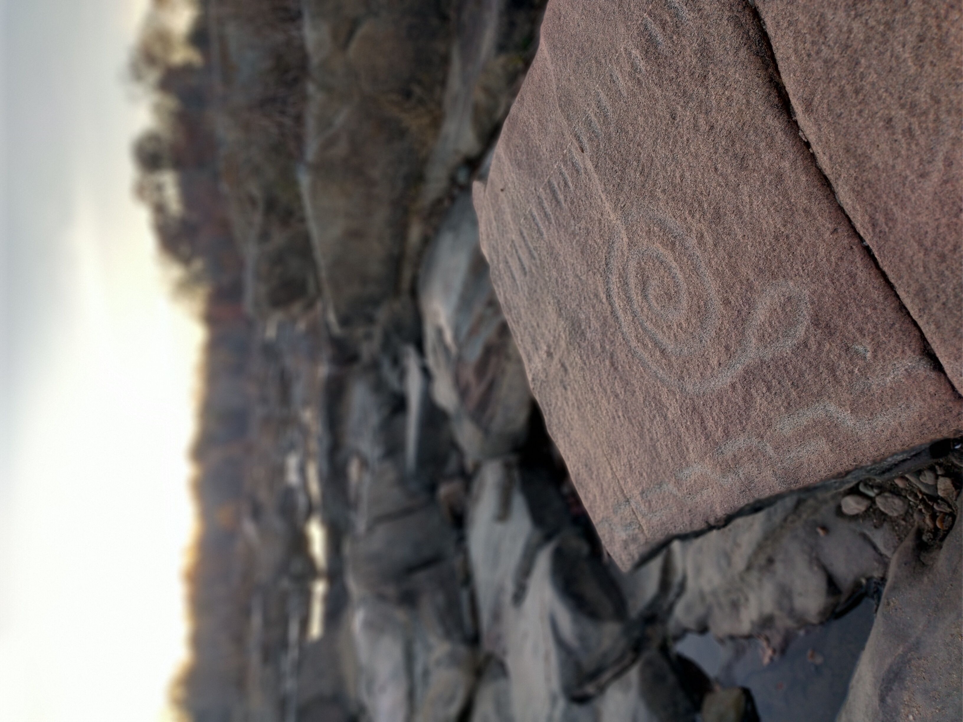
The river's flow over eons has sculpted the rocks into channels, ledges, and potholes. Swirling eddies carrying sand and pebbles drill circular potholes into the bedrock – likely the origin of features like the Recess Pool and perhaps even the initial form of the Indian Punch Bowl before it was enhanced by humans. These reflective pools would naturally collect rain and river water, forming still mirrors on the rock surface.
Seasonal water flow plays a crucial role in preservation: during normal conditions, some carvings lie above water (gaining patina but safe from constant abrasion), yet in floods they submerge (which can actually protect carvings by depositing silt and reducing wind weathering). This intermittent submergence helps preserve petroglyphs by limiting exposure to sun and thermal stresses.
Ancient Bedrock
Understanding the geology and hydrology of the falls area provides insight into why these ritual features exist here and how they have endured. The Rappahannock falls cut through ancient crystalline rocks of the Piedmont. The bedrock, known as the Fredericksburg Complex, includes blue-gray biotite granite, gneiss, and schist formed hundreds of millions of years ago. This exposed **ancient bedrock** along the Rappahannock River is part of the **Piedmont geological formation**, composed primarily of metamorphic and igneous rock dating back **over 1 billion years**. These rocks are remnants of ancient mountain-building events that predate even the Appalachian Mountains. Their hardness and resistance to erosion are what form the dramatic **rocky outcrops and rapids** at the river’s Fall Line. For Native peoples, these formations weren’t just obstacles — they were **landmarks, tools, and sacred spaces**. The bedrock provided durable surfaces for carving **petroglyphs**, **grinding corn**, or creating **celestial markers** that aligned with the sun and stars. The flat surfaces and natural formations made ideal locations for gatherings, ceremonies, or food processing. These enduring rocks connected people to deep time, acting as **literal and spiritual foundations** — unchanging witnesses to the lives, beliefs, and traditions of generations who lived along the river. In many Indigenous traditions, such bedrock was seen as **alive** with memory and spirit.
Three Worlds Cosmology in Stone
Indigenous Eastern Woodlands cosmology organized the universe into three tiers, and the fall line naturally embodied this sacred geography. The dramatic landscape - with its ancient resilient rocks, sculpted by water into meaningful shapes (bowls, channels, shelters) - created a naturally sacred topography that enabled both the creation of ritual sites and helped preserve them through millennia.
Sacred Landscape
In high water, some sites might be unreachable on small islands. This dynamic accessibility could have ritual implications: perhaps certain ceremonies were only done at low water (e.g. a drought-time appeal to the river spirit, when Snake Rock fully emerges), or conversely at high water (celebrating the floodwaters that bring spawning fish). The reflective pools, notably, would be most effective in dry times when they hold still rainwater rather than being part of flowing currents. It is tantalizing to consider that the petroglyphs might align with such cycles: e.g. a carving that only becomes visible in drought could signal it’s time to perform a rainmaking ritual. Indigenous peoples certainly observed such natural rhythms closely. In summary, the geology and hydrology of this region created a naturally sacred topography: ancient resilient rocks for carving, sculpted by water into meaningful shapes (bowls, channels, shelters), and a river whose changing moods would have structured the timing of human activities. These natural factors both enabled the creation of ritual sites and helped preserve them to the present day.
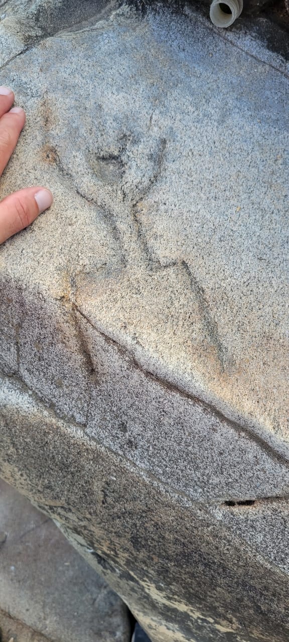
Ancient Stone Carvings
Indigenous inhabitants likely maintained weirs seasonally, and the rock features we discuss would have been immediately nearby on the landscape. This is significant: if people congregated here every spring for the shad run, they would become intimately familiar with each rock, pool, and alcove – naming them, marking them, perhaps mythologizing them (e.g. “the rock where the snake spirit lives”). The water flow itself may have inspired the symbolism: the meandering snake carving could mirror the course of the river as seen from a high perch; swirling eddies may have suggested spiral icons. Geologically, the durability of the granite is why any carvings survive at all. Granite and gneiss are hard (Mohs hardness ~6-7), requiring effort to peck or incise. The creators of the petroglyphs would have needed hammerstones, flint chisels, or repeated heating and cooling to crack the rock. That investment of labor in carving underscores the importance of these symbols. Once carved, however, the hardness of the rock resists further erosion – thus a snake or human figure can persist for millennia. The fall line’s rocks, being exposed since the last Ice Age (when the river established its course), might hold carvings potentially dating back to the Archaic period (several thousand years ago). Given that petroglyphs in similar Piedmont contexts (like Safe Harbor, PA, or Great Falls, VA) have been dated to 1000 BCE or older, it’s conceivable Fredericksburg’s carvings are of comparable antiquity. The patina on the carved surfaces – a dark varnish from weathering – can be an indicator: Snake Rock’s carving has a heavy dark patina, suggesting great age, whereas any freshly cut rock would be light gray. Observers have indeed noted that Snake Rock’s stone looks “different” (likely older or sourced differently)
Upper World
The Overlook: Connected to sky, sun, moon, and stars through elevation and celestial access. The elevated bedrock formations provided natural astronomical observation platforms.
This World
Islands & Shores: The middle realm where humans could safely dwell while accessing both spiritual realms. The resistant bedrock islands formed natural refuges amid the rapids.
Lower World
Snake Rock & Pools: Gateways to the underwater realm of water spirits and the Great Serpent. Natural potholes and carved basins served as portals to the aquatic underworld.
⚡ Geological Durability and Sacred Permanence
The durability of the granite is why any carvings survive at all. Granite and gneiss are hard (Mohs hardness ~6-7), requiring significant effort to peck or incise. The creators of the petroglyphs would have needed hammerstones, flint chisels, or repeated heating and cooling to crack the rock. That investment of labor in carving underscores the importance of these symbols.
Once carved, however, the hardness of the rock resists further erosion – thus a snake or human figure can persist for millennia. The fall line's rocks, being exposed since the last Ice Age when the river established its course, might hold carvings potentially dating back to the Archaic period (several thousand years ago). The patina on the carved surfaces – a dark varnish from weathering – indicates great age.