Sacred Native Sites Today
Where Ancient Wisdom Meets Modern Discovery
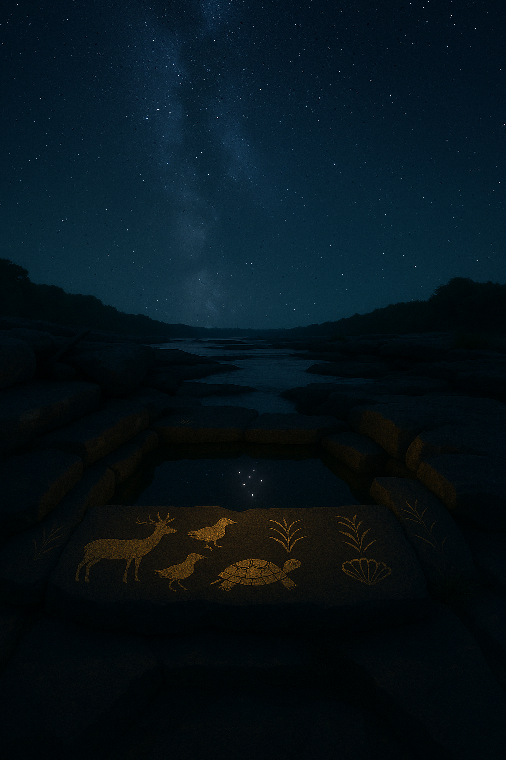
The fall line complex preserves an integrated ceremonial landscape where astronomy, spirituality, and daily life converged for thousands of years. Each site preserves ancient wisdom encoded in stone and water.
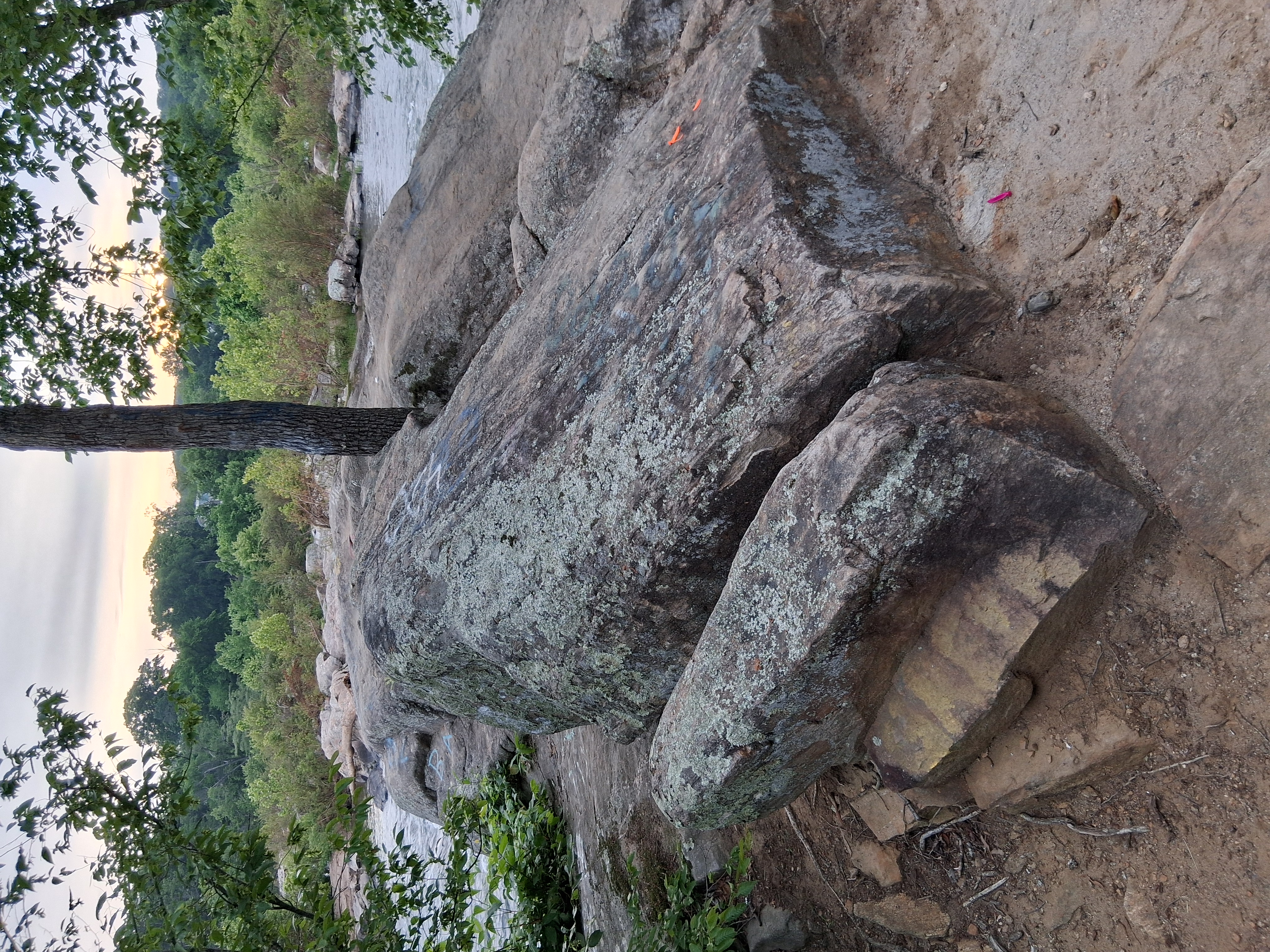
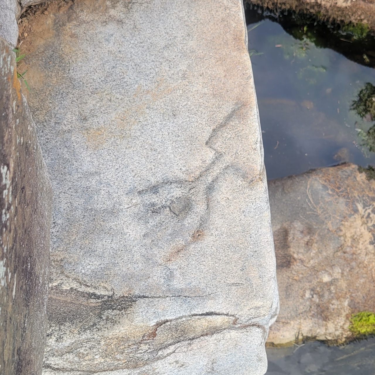
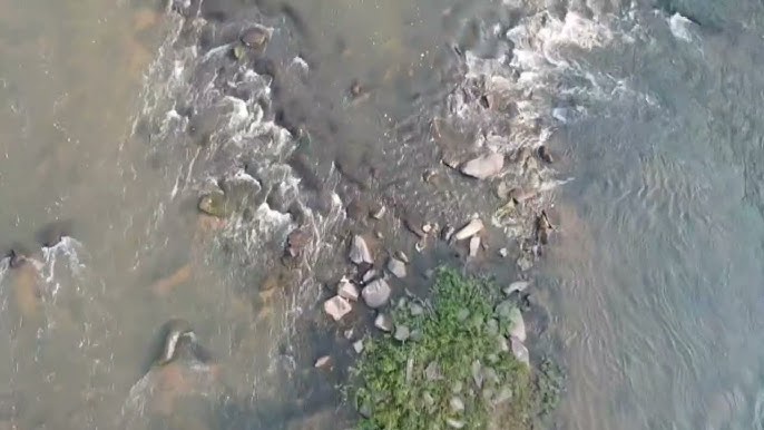
🐍 Snake Rock
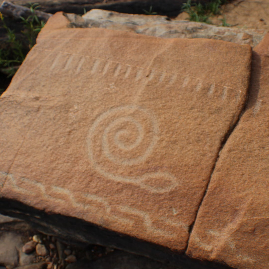
The Serpent Petroglyph
Ancient serpent carving functioning as a hydrological gauge and spiritual guardian
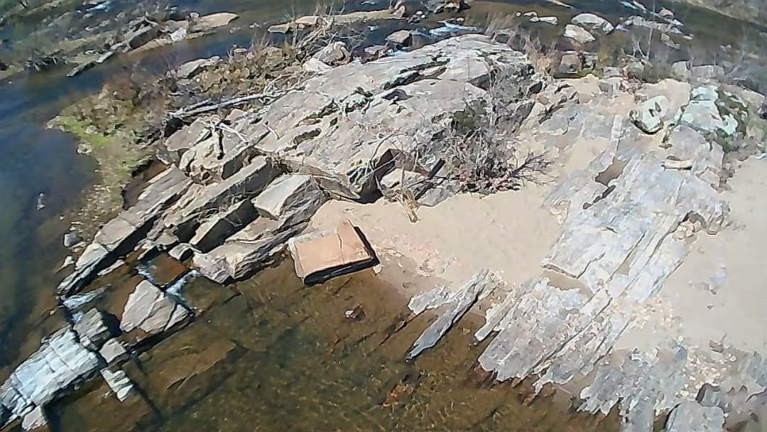
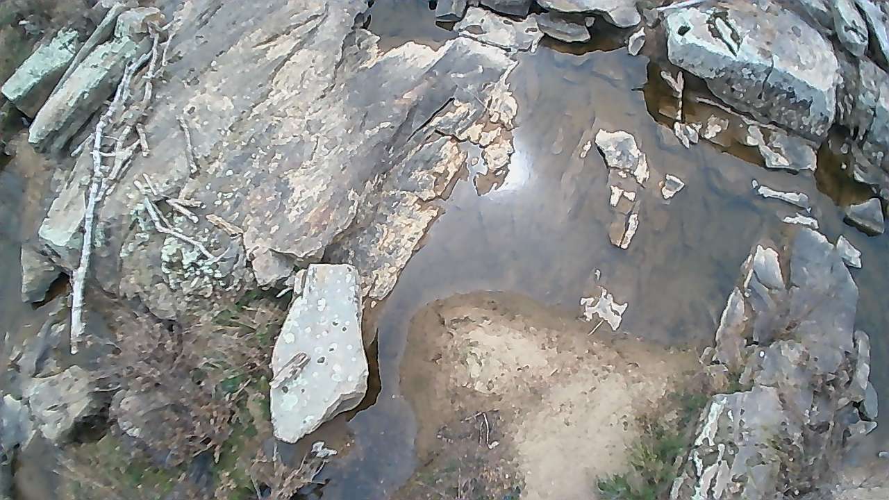
Aerial Perspective
Drone photography reveals Snake Rock's strategic position in the river
Guardian of the Waters
This remarkable serpent petroglyph, carved using traditional stone-on-stone percussion techniques, spans approximately three feet in length. The carving functions as a natural hydrological gauge - during normal flow, only portions remain visible, but during droughts, the complete petroglyph emerges as a dramatic environmental indicator.
☀️ Astronomical Significance
Snake Rock's position aligns with summer solstice sunrise as viewed from the Overlook and Indian Punch Bowl areas. In Algonquian cosmology, the Great Horned Serpent represented powerful spiritual forces controlling river flow, fish abundance, and rainfall timing.
📏 Living Water Gauge
The petroglyph literally resides in the water serpent's domain, creating symbolic and practical links between the carved image and the spiritual force it embodies. As water levels change, different portions of the serpent become visible, providing crucial environmental information.
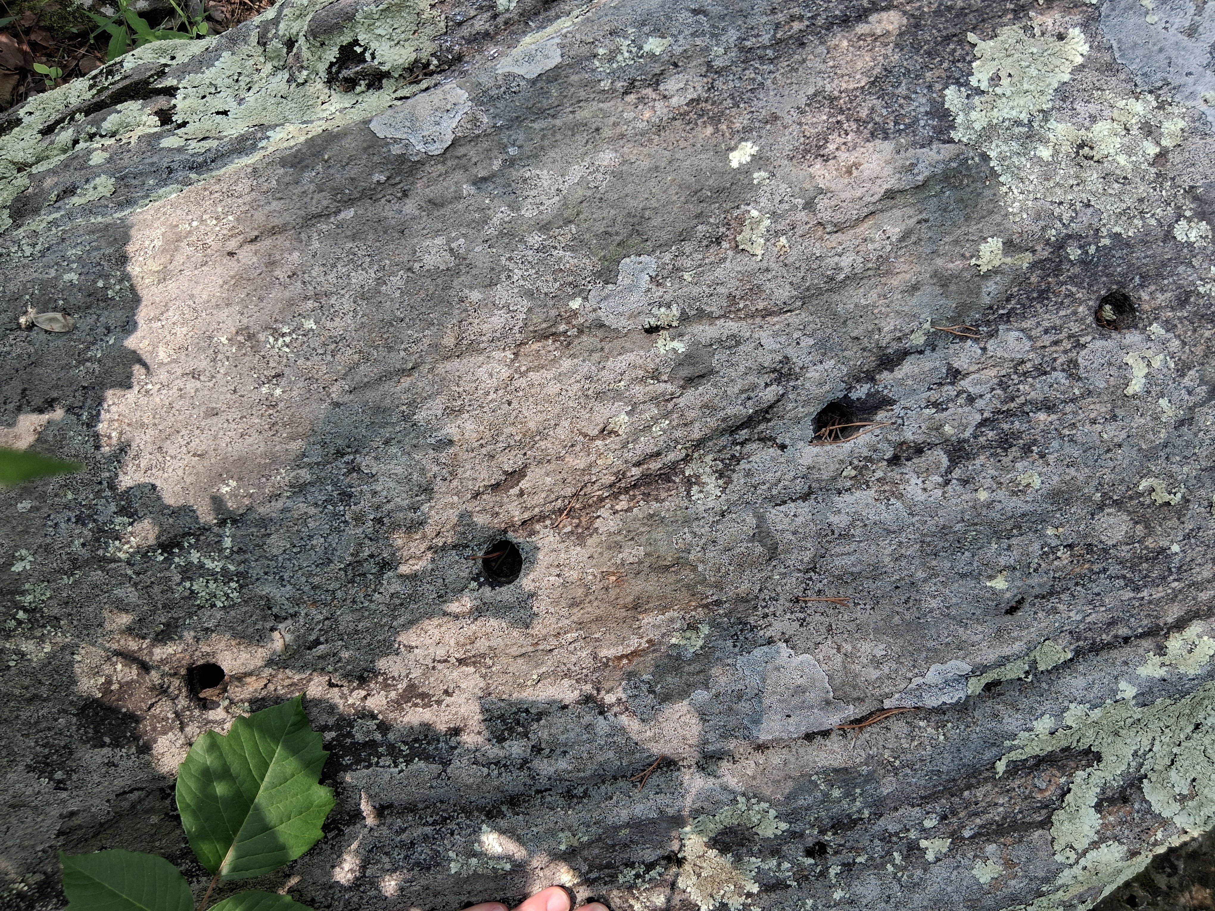
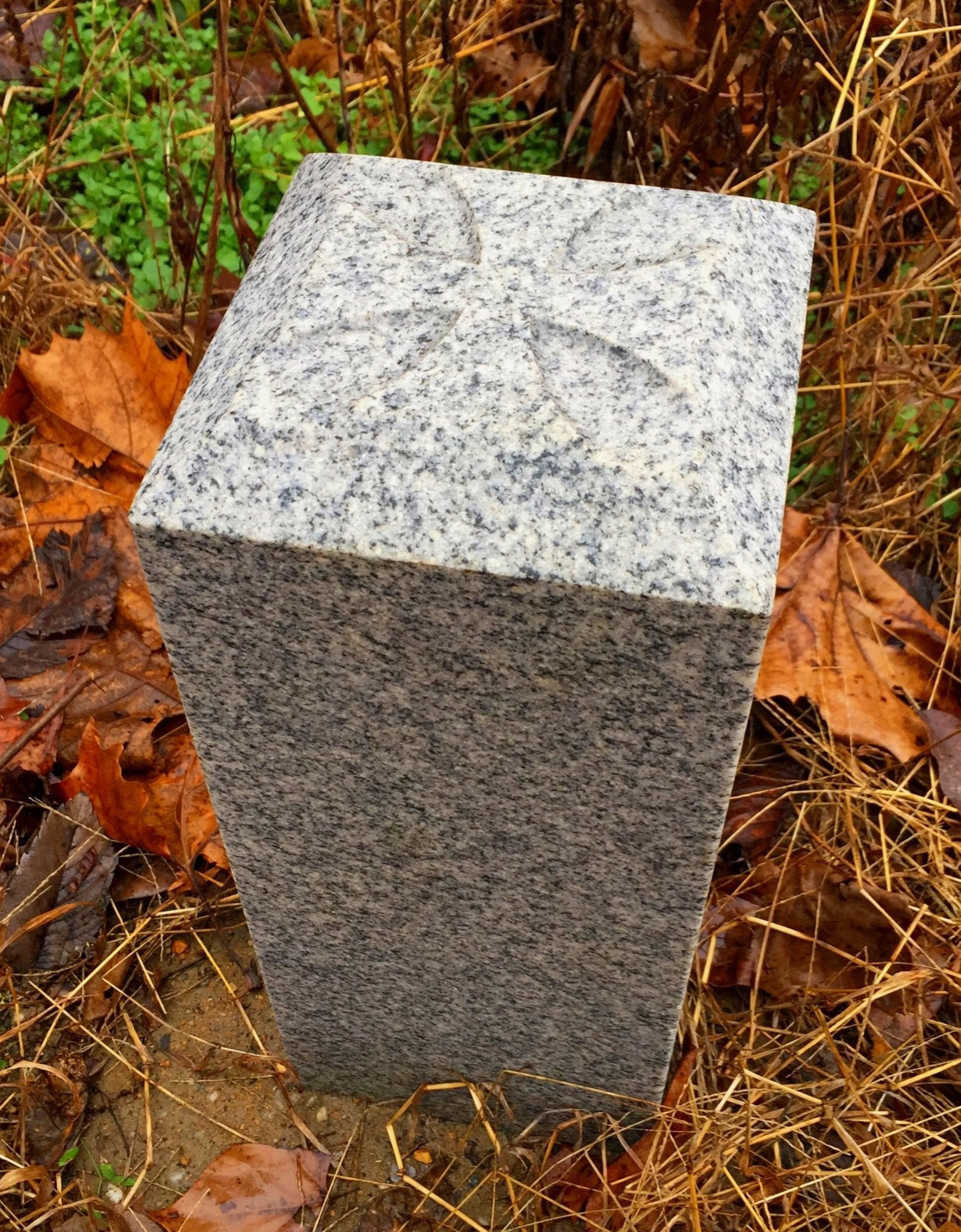
🏺 Indian Punch Bowl
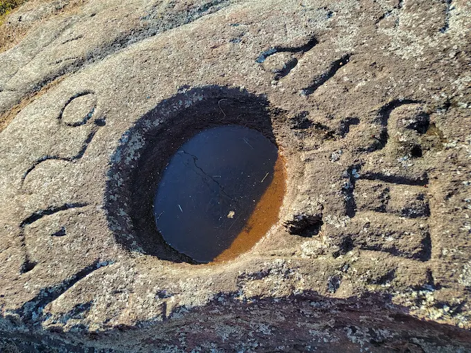
The Sacred Basin
Ancient ceremonial bowl showing Major Thornton's 1720 colonial inscription
Ceremonial Basin & Community Hearth
This precisely carved granite basin measures approximately three feet in diameter and one to two feet deep, representing hundreds of hours of patient stone working. The smooth, hemispherical cavity shows clear evidence of human manufacture requiring sustained community effort over extended periods.
Multiple Sacred Functions
- 🏹 Arrow poison preparation: Historical records document tribal use for mixing plant-based substances
- 🌽 Ceremonial food preparation: Grinding corn, mixing beverages for seasonal gatherings
- 🏺 Ritual vessel preparation: Processing materials for ceremonies like the Powhatan wysoccan drink
🏛️ Colonial Appropriation
Major Francis Thornton's 1720 inscription "1720 F.T." around the rim represents colonial appropriation that paradoxically preserved the feature through recreational use. The bowl's astronomical positioning offers commanding views with potential equinox sunrise alignments.
🏔️ The Overlook
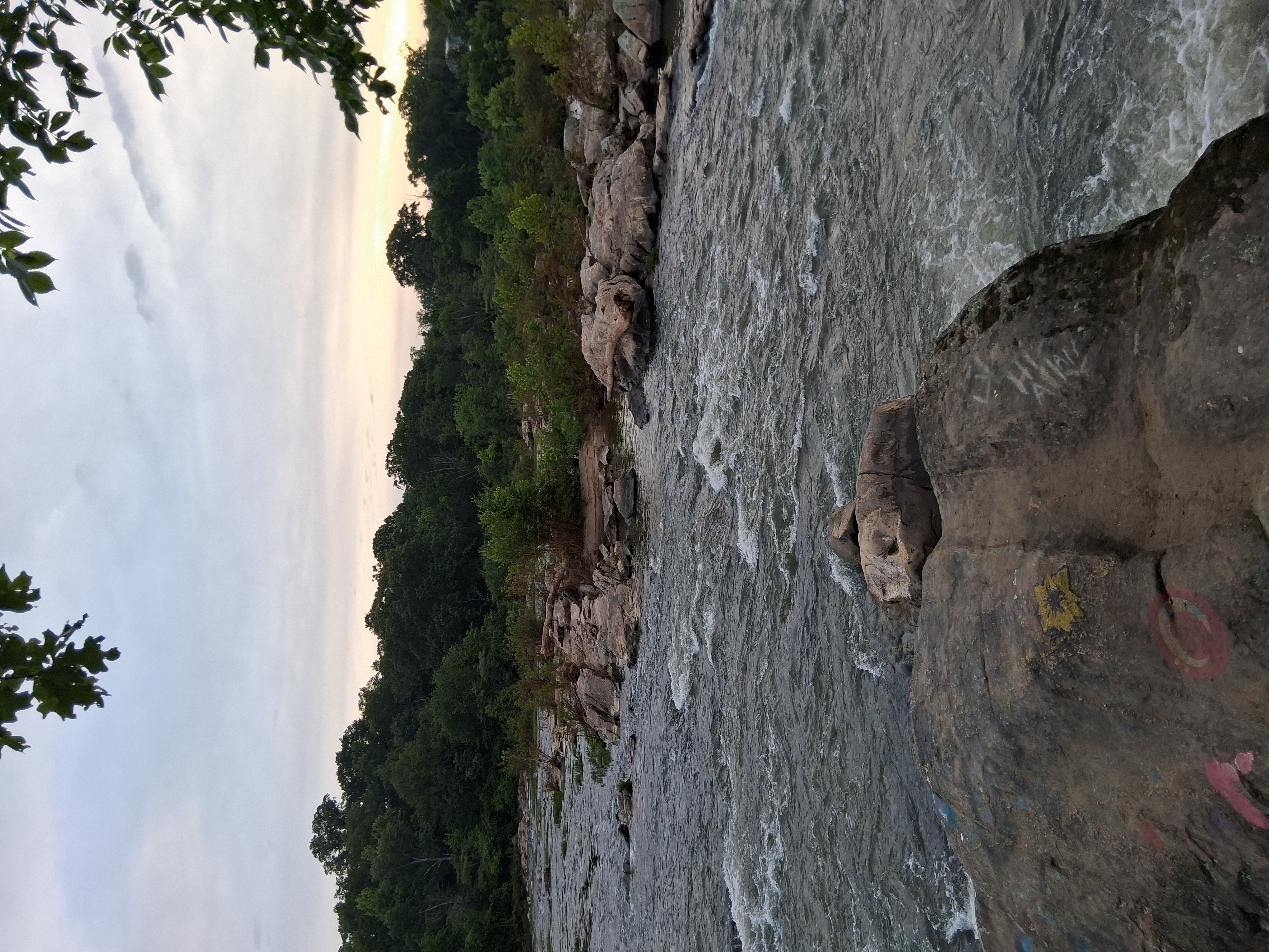
Portal to the Upper World
The sacred overlook capturing the golden hour when ancient astronomers observed celestial events
Sacred Stone Formation
Detailed view of the ancient granite formations that provided perfect astronomical observation platforms
🪨 Portal to the Upper World
This rocky promontory provides commanding views of the entire fall line complex while creating ideal conditions for astronomical observation and sky-oriented ceremonies. The site's strategic value included monitoring river traffic, tracking game movements, and maintaining long-distance communication through signal fires.
Sacred Stone Openings
Natural rock crevices and formations that may have served ceremonial functions
Astronomical Functions
- 🌌 Equinox alignments: Eastern vista aligns with equinox sunrise along the river's course
- ☀️ Solstice observations: Summer solstice sunrise appears over northeastern hills
- 🌙 Lunar tracking: Elevated position ideal for full moon ceremonies
- 📅 Stellar calendar: Clear horizons for tracking Pleiades, Big Dipper, and seasonal markers
👂 Natural Sound Chamber
Rock crevices that enhanced acoustic properties for ceremonial activities
📢 Natural Amphitheatre
The Overlook's acoustic properties created natural amphitheater effects where ceremonial sounds could project across water while maintaining elevation-based authority and mystery.
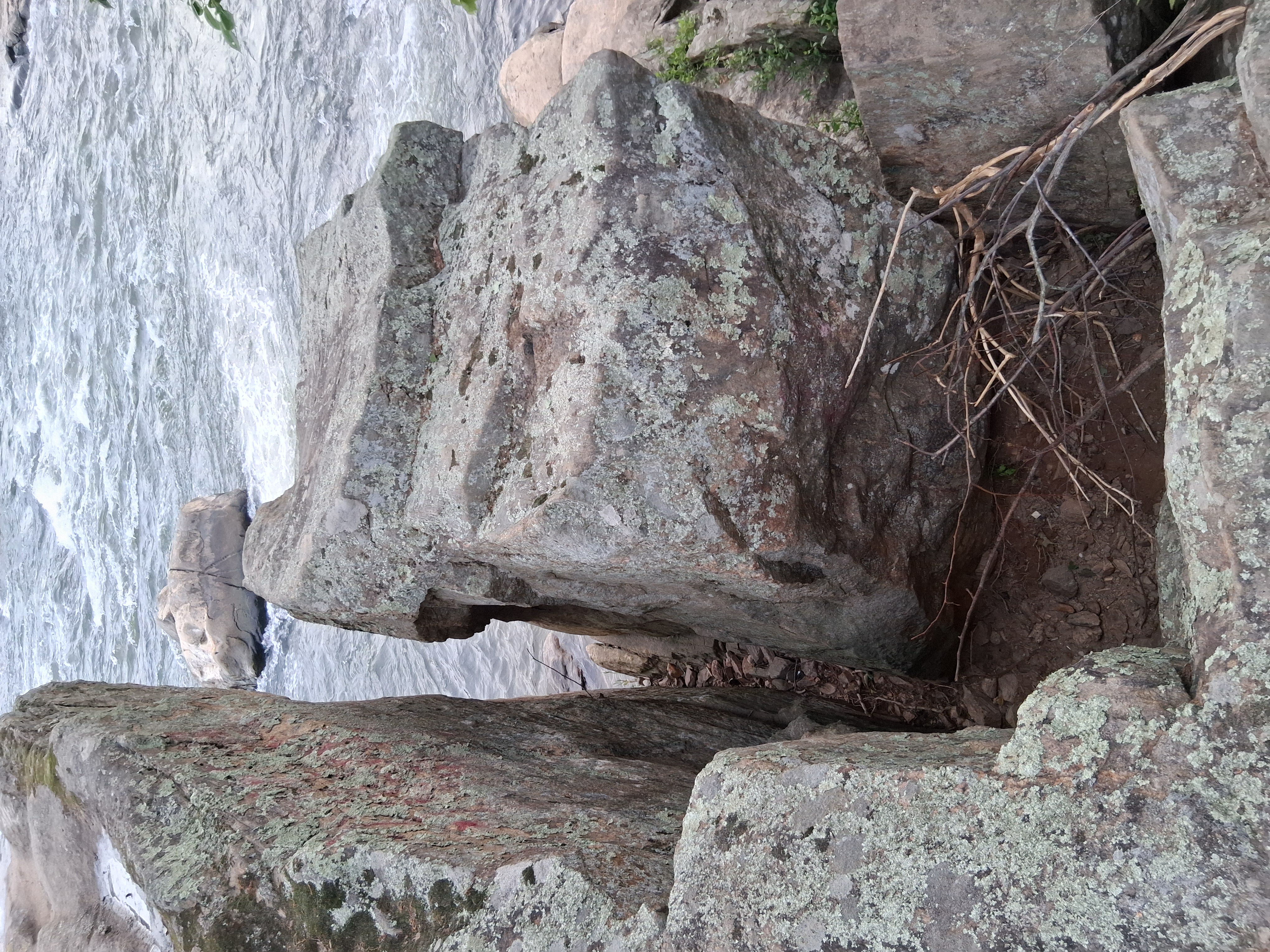
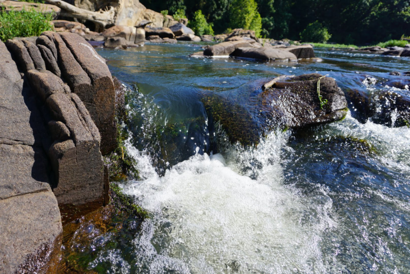
🌊 The Recess Pool
Sacred Water Basin
The naturally carved basin maintaining tranquility amid turbulent rapids
Mirror of the Cosmos
Aerial view showing the perfectly round recess pool amid the turbulent rapids
🪞 Natural Star Mirror
The still water surface creating perfect conditions for astronomical reflection ceremonies
🌌 Mirror of the Cosmos
This naturally carved basin, formed through pothole drilling processes, creates calm tranquility amidst surrounding rapids. The pool's remarkable ability to remain clear and still during floods makes it function as a natural mirror for astronomical observation.
Spiritual & Practical Functions
- 🔭 Astronomical Mirror: Safe observation of sun, moon, and star reflections
- 🤲 Ceremonial Purification: Reliable water source for ritual cleansing
- 🐟 Fish Sanctuary: Sheltered environment attracting diverse species
- 👁️ Vision Medium: Still water understood as communication portal with spirit world
🏞️ Sacred Capacity
The pool reaches depths over eight feet with several thousand gallons capacity when full, supporting substantial ceremonial gatherings while maintaining natural filtration through granite surroundings.
🏃 Jumping Man Petroglyph
🪶 The Dancing Spirit
Rare Eastern Woodlands rock art depicting a human figure in ceremonial dance or ritual leap
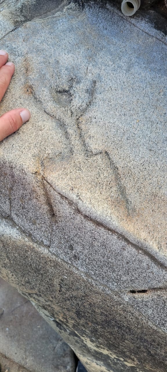
🖌️ Ancient Artistry
Close-up detail showing the weathered but unmistakable human figure carved into the granite
🪶 The Dancing Spirit
This faint but authentic petroglyph depicts a human-like figure with outstretched arms and legs, appearing to leap or dance. Located on a partially submerged rock near the rapids, this carving represents one of the rarest examples of Eastern Woodlands rock art.
👁️ Ceremonial Significance
The figure likely depicts a ritual dance or shamanic transformation. In Indigenous cultures, rapids and falls were considered dwelling places of powerful spirits, and a human petroglyph here might represent a shaman or spirit dancer appeasing those forces.
🌞 🐍 Sacred Alignment
The Jumping Man's position creates a symbolic line across the water to Snake Rock, as if the human and serpent figures are in eternal dialogue between the realms of earth and water.
⚔️ Captain John Smith Marker
1608 Exploration Commemoration
Historical marker commemorating John Smith's fateful encounter with the Manahoac at the falls
⛵ 1608 Exploration Commemoration
This marker commemorates Captain John Smith's historic August 1608 expedition to the Rappahannock falls, where he encountered a large gathering of Manahoac peoples and captured Amoroleck. The encounter marked the first documented European contact with the sacred ceremonial landscape.
🧭 Historic Meeting Point
From this vantage point on Fall Hill, Smith's party would have had commanding views of the fall line complex and the large indigenous encampment below. The marker represents the moment when two worlds collided at this sacred confluence.
🤝 Cultural Intersection
What Smith recorded as a simple "hunting party" was likely a significant spiritual gathering at one of Virginia's most sacred locations. The presence of multiple tribal chiefs suggests this was a ceremonial event of great importance.
💧 Buttermilk Falls
Sacred Cascade
The smaller waterfall that provided intimate ceremonial space within the greater fall line complex
Sacred Cascade
This smaller waterfall within the fall line complex provided a more intimate ceremonial space for individual spiritual practices and small group rituals. The gentler flow created ideal conditions for purification ceremonies and quiet meditation.
Purification Site
The clearer, calmer waters of Buttermilk Falls made it particularly suitable for ritual cleansing and preparation before larger ceremonies at the main falls. The site likely served as a place for spiritual preparation and individual vision seeking.
Year-Round Access
Unlike the main rapids which could be dangerous during high water, Buttermilk Falls provided reliable access to flowing water throughout the seasons, making it an essential component of the ceremonial landscape.
🏕️ Haqqasod Mahaqasod
Seasonal Hunting Village/Camp
The location of the great seasonal gathering place where multiple Manahoac bands converged for ceremonies and communal hunts
🏕️ Seasonal Hunting Village/Camp
Known to Smith as "Mahaskahod," this was described as a "hunting town" that temporarily housed "several hundred Indians from four or more distant villages of the Manahoac." The site represents one of the largest documented intertribal gatherings in early Virginia.
🎭 Ceremonial Convergence
The seasonal nature of this settlement suggests it was more than a simple hunting camp—it was a planned ceremonial gathering that coincided with fish runs, astronomical events, and seasonal transitions. Multiple Manahoac bands would coordinate their movements to converge here.
🪶 Archaeological Potential
This site holds tremendous archaeological potential for understanding pre-contact intertribal relationships and ceremonial practices. Evidence of temporary structures, fire pits, and artifact scatters could reveal the organization of these massive seasonal gatherings.
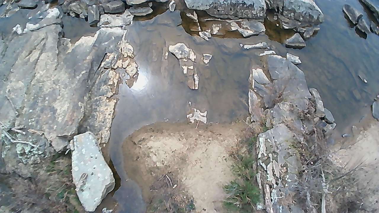
🐟 Native Fishing Weir
🪝 Ancient Fishing Technology
Stone alignments in the river marking the location of sophisticated fish traps used for thousands of years
🎣 Ancient Fishing Technology
These V-shaped stone alignments in the river represent the remnants of sophisticated fish weirs that guided migrating shad, herring, and sturgeon into wooden traps. The engineering required community coordination and demonstrated deep understanding of fish behavior and river hydraulics.
🤲 Ceremonial Fishing
In Algonquian tradition, the first catch from a weir each season required specific rituals—prayers and tobacco offerings to ensure the river spirits continued to send fish. The weirs thus served both practical and spiritual functions within the sacred landscape.
🥅 Sustainable Harvest
The design allowed smaller fish and breeding stock to pass through while capturing mature fish for the community. This sustainable approach maintained fish populations while providing abundant protein for seasonal gatherings.
🚢 French John's Wharf
Historic Landing & Freedom Station
Colonial-era wharf that became a crucial stop on the Underground Railroad during the Civil War era
📜 Historic Landing & Freedom Station
This colonial-era wharf was built upon ancient indigenous landing sites that had served as canoe launches and trading posts for thousands of years. The natural topography and river access made this location ideal for watercraft of all types, from dugout canoes to steamboats.
👨🏿🌾 French John's Legacy
The wharf bears the name of "French John," a remarkable figure who operated a ferry and landing service here during the antebellum and Civil War periods. French John, whose full name was Jean-Baptiste Dubois, was a French immigrant who arrived in Fredericksburg in the 1840s. Despite not being directly connected to Native American culture, his story represents the continuing importance of this river crossing for people seeking freedom and opportunity.
🚂 Underground Railroad Connection
During the Civil War era, French John's Wharf became a crucial stop on the Underground Railroad. French John, sympathetic to the abolitionist cause, used his legitimate ferry operations as cover for helping enslaved people cross the Rappahannock on their journey to freedom. The same river that had carried Indigenous peoples to sacred ceremonies now carried those fleeing bondage toward liberty.
💥 Civil War Significance
The wharf's strategic location made it important during the Civil War, as Union and Confederate forces alternately controlled the river crossing. French John's knowledge of the river's moods and currents—wisdom that echoed the ancient understanding possessed by Indigenous peoples—proved invaluable to both military operations and freedom seekers.
⛓️💥 Honoring All Who Sought Freedom
While not directly connected to Native American culture, we honor French John's Wharf for its crucial role in helping enslaved peoples seek freedom. The site demonstrates how the sacred geography of river crossings continued to serve those seeking transformation and liberation, carrying forward the spiritual significance of this place as a threshold between worlds—from bondage to freedom, from the known to the unknown.
🌉 Continuity of Crossing
The site demonstrates remarkable continuity—from indigenous dugout canoes to colonial sailing vessels to Underground Railroad operations to modern recreational boats. The same geographic advantages that drew Native peoples continue to make this an important river access point, now serving as a reminder of how sacred spaces can serve multiple liberation movements across the centuries.
🏘️ Patawomeck Village
Algonquian Settlement
Site of one of the major Patawomeck villages that controlled access to the sacred fall line from the east
🛖 Algonquian Settlement
The Patawomeck village near the falls represented the eastern gateway to the sacred ceremonial landscape. As part of the Powhatan confederacy, they controlled river access and maintained the delicate political balance that allowed the falls to function as neutral ceremonial ground.
💪 Strategic Position
Located downstream from the main rapids, the village was positioned to monitor all river traffic while remaining safe from the seasonal floods that could devastate settlements too close to the falls. This strategic location allowed them to serve as intermediaries between different cultural groups.
🪶 Cultural Guardians
The Patawomeck played a crucial role in maintaining the sacred protocols that governed use of the fall line. Their presence ensured that ceremonial activities proceeded according to ancient traditions while protecting the sites from inappropriate use.